Interlaken: Hiking Up the Harder, Lake Thun and an Old Château Ruin (100 Days in Europe, Part 3)
Part 3 of 24 in the 100 Days Europe Travel Journal, our 100-day trip across Europe by train, plane, ferry and bus.
Interlaken’s name is a description of where it stands. It comes from the Latin inter lacus, “between the lakes”, and that is exactly how I summed the town up in my first diary line below. Part 3 covers our three days there, Days 4 to 6 of the trip: a train ride my notes call the most beautiful train journey, a hike up the Harder when the funicular was closed, and a rainy walk to Lake Thun. The diary notes are kept exactly as I wrote them; after each one I have added what the official sources say about the places in it.
Between the lakes
Interlaken – between lakes Brienz and Thun, alongside river Aare. Calm, peaceful mountainous region. 560m above sea level. Swiss German. Very quiet in low season. Good weather important for outdoor activities.
My notes match the encyclopaedia closely. Britannica describes Interlaken as a town in the canton of Bern, on the Aare, built on a flat plain called the Bödeli between Lake Brienz to the east and Lake Thun to the west. It gives the height as 568 metres above sea level, so my “560m” was a slight round-down. The town grew up around a convent of Augustinian canons (1130–1528) and is one of Switzerland’s oldest summer resorts, which may help to explain why it felt so quiet in low season. The language is Swiss German, as I noted: the canton’s population, Britannica says, is mainly German-speaking.

Day 4: the most beautiful train journey
Day 4: Most beautiful train journey. Question about registering itinerary in Global Pass. Nice SBB staff. Panoramic 180° views – train under or on top of mountains. Incredible. Accidentally in 1st class briefly.
Arrived Interlaken. New residence: big apartment for 7 (minimum tools). WhatsApp instructions for key. Groceries at Migros. Movie, pizza, beer.
The ride from Montreux (Part 2) is the one in the video at the top of this page. My notes call it incredible, with panoramic 180° views as the train ran under or on top of the mountains. We had a question about registering the itinerary in our Global Pass, the SBB staff were nice, and for a short while we sat in first class by mistake. Then we settled into a big apartment for seven, with groceries from Migros, a film, pizza and beer.
Day 5: up the Harder on foot
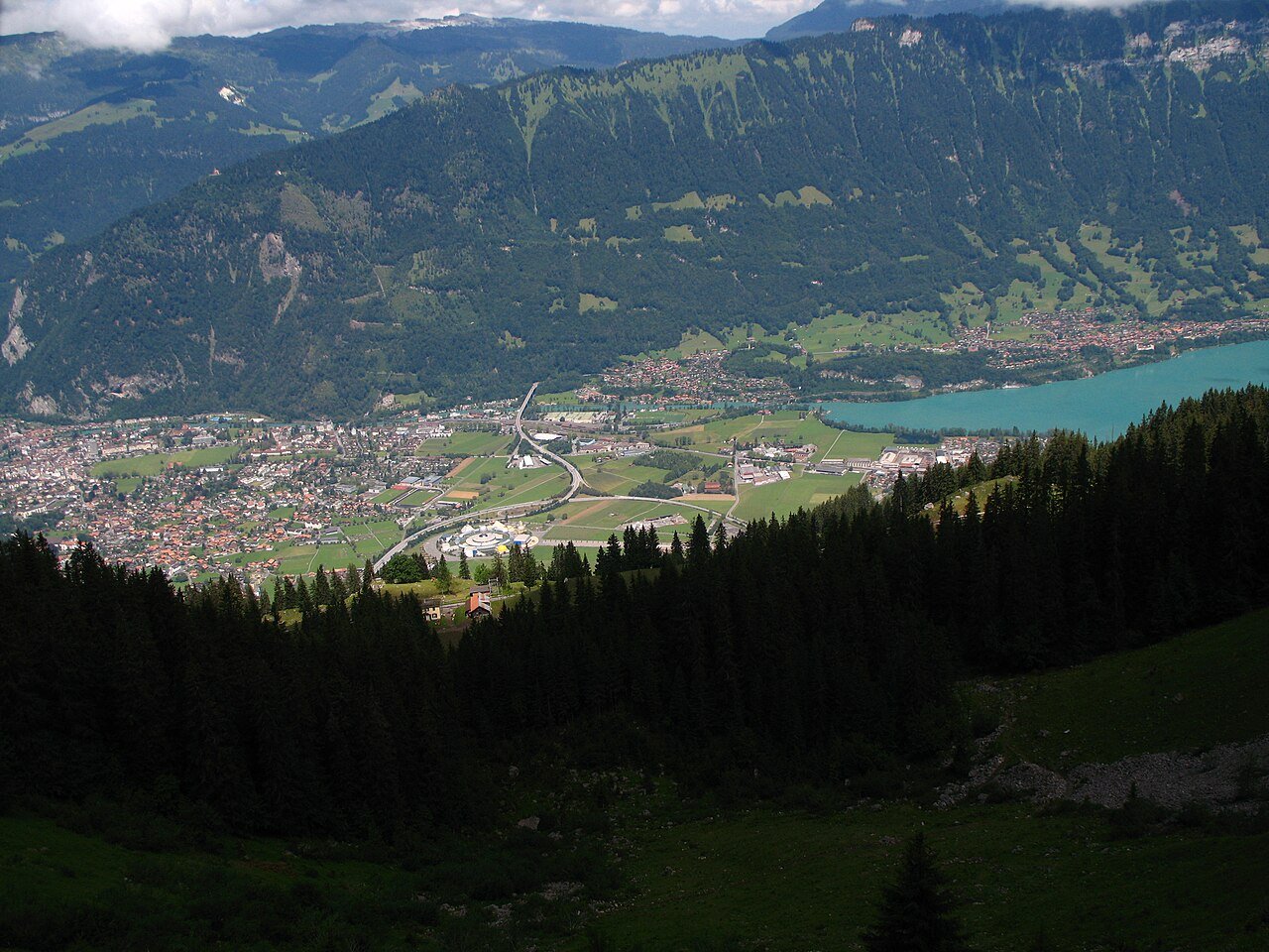
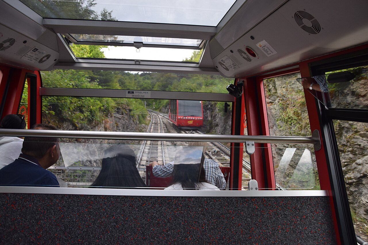
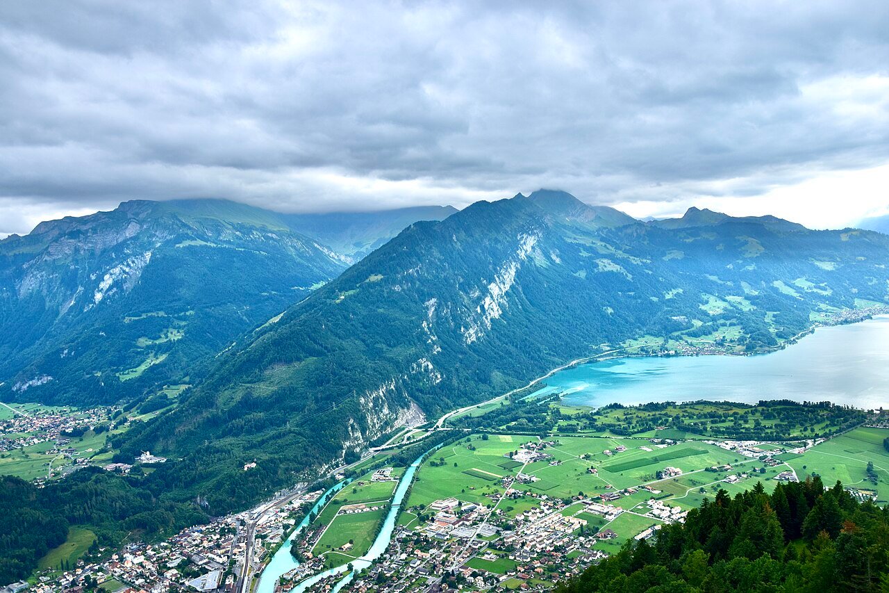
Day 5: Harderbahn Funicular closed till April. Hiked up anyway. Scary at first (soft floor, hidden rocks) but peaceful – air, leaves, birds, occasional train. Reached ~100m with magnificent views of Interlaken, Aare, Lake Brienz.
The Harderbahn is Interlaken’s funicular to Harder Kulm, the viewpoint above the town. Jungfrau Railways, which runs it, puts the summit station at 1,322 metres and the ride at ten minutes from the valley station. It is a seasonal railway: the Bernese Oberland pass operating table gives this year’s season as 3 April to 29 November and adds “no winter operation”, which matches what we found. Since the town lies at 568 metres, the full climb to the top is about 750 metres. My note says we reached about 100 m, which suggests only the lower part of the path, but the view of Interlaken, the Aare and Lake Brienz was already there.


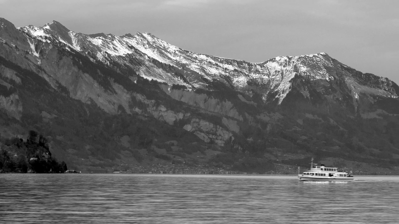
Walk along river to Lake Brienz – classic Alpine postcard. Drone flying (landscape photographer’s dream). Swiss chocolate stop.
Lake Brienz really does look like a postcard, and there is a reason for its colour. Interlaken Tourism explains that the turquoise comes from very fine glacial sediment carried in by the Lütschine and the Aare; the particles sink so slowly that they colour the water, and the lake is clean enough to show it. The same page gives the lake as 14 km long and 2.8 km wide, and up to 260 metres deep.

Day 6: Lake Thun in the rain
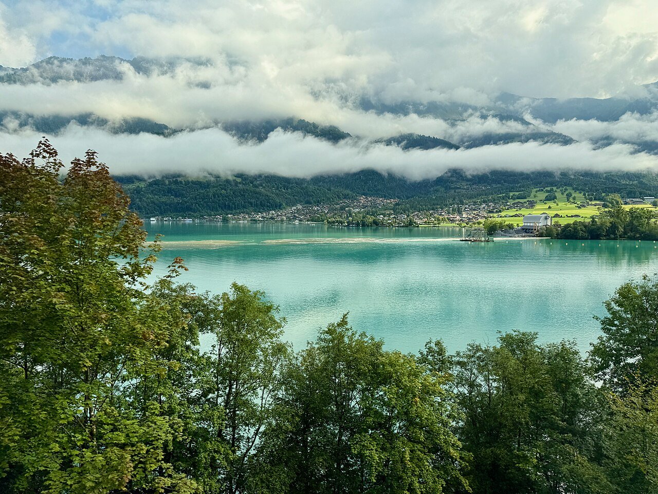
Day 6: Cloudy + light rain, mystical clouds on mountains. 40 min walk to lake Thun. Old chateau ruin. Tried drone – almost broke it (bad landing pad). Flew on 2nd try but no GPS. Rain stronger. Walked back through pine forest on other side of river. New sound: rain on dry leaves.
Lake Thun is the lake the Aare flows into after leaving Interlaken, on the western side of the Bödeli. My notes do not name the château ruin, so I have not guessed which one it was. The rest of my Day 6 note is about the weather: mystical clouds, light rain that grew stronger, and, on the way back through the pine forest, a sound I had not noticed before, rain falling on dry leaves.

A note on flying drones in Switzerland
These notes mention two drone flights: one by Lake Brienz on Day 5 and the near miss on Day 6. The rules have changed since our trip: Switzerland adopted the EU drone regulation in January 2023, as the FOCA drone FAQ notes. Under the current open-category rules of the Federal Office of Civil Aviation (FOCA), a drone may fly no higher than 120 metres above the ground, must stay within the pilot’s visual line of sight, may not fly over crowds and must respect no-fly zones. Losing GPS, as happened to us, makes that line-of-sight rule even more important.
THE AARE, EAST TO WEST
(heights from the sources cited)

 LAKE BRIENZ  (east)
 turquoise, 14 km long
      |
      |  the Aare
      v
 INTERLAKEN  568 m
 on the Bodeli plain
      |   Harder Kulm 1,322 m
      |   rises just above it
      |  the Aare
      v
 LAKE THUN  (west)
 our Day 6 walk
The takeaway: Interlaken is a town best understood from its map. It sits on a flat plain between two lakes, joined by the Aare, with the Harder rising straight above it. In low season the town is very quiet and some things, like the Harderbahn, simply stop until spring; good weather matters, as my first note says. Our three days still gave us a panoramic train ride, a hike in place of the funicular, two lakes and a lesson in drone landings. If you fly a drone there today, read the Swiss rules first and keep it where you can see it.
The next morning we took the train on to Lucerne (Part 4).
100 Days Europe Travel Journal · Part 3 of 24
← Previous: Montreux: Lake Léman, Chillon Castle and the Queen Studio (100 Days in Europe, Part 2) | Next: Lucerne: Chapel Bridge, Mount Pilatus and the River Reuss (100 Days in Europe, Part 4) →
More from the journey: the Europe Travel page (all fifteen parts) · every Switzerland post · Part 1: Geneva · Part 2: Montreux · Part 4: Lucerne · Part 5: Zurich